A Guide to the Ridgeland History Trail
To the casual observer, Ridgeland, Mississippi, presents the polished look of a modern suburban success story. You see upscale retail centers like Renaissance at Colony Park and bustling roads. However, a closer look reveals that the city is like a hidden map where earlier layers of human life wait to be rediscovered. The Ridgeland History Trail helps you peel back these layers. By following the 22 markers, you can go on a journey that spans over 13,000 years. You will travel from the time of Paleo-Indian hunters to the high-speed shopping of the 21st century.
The Ancient Trace: Markers 2, 8, 10, and 20
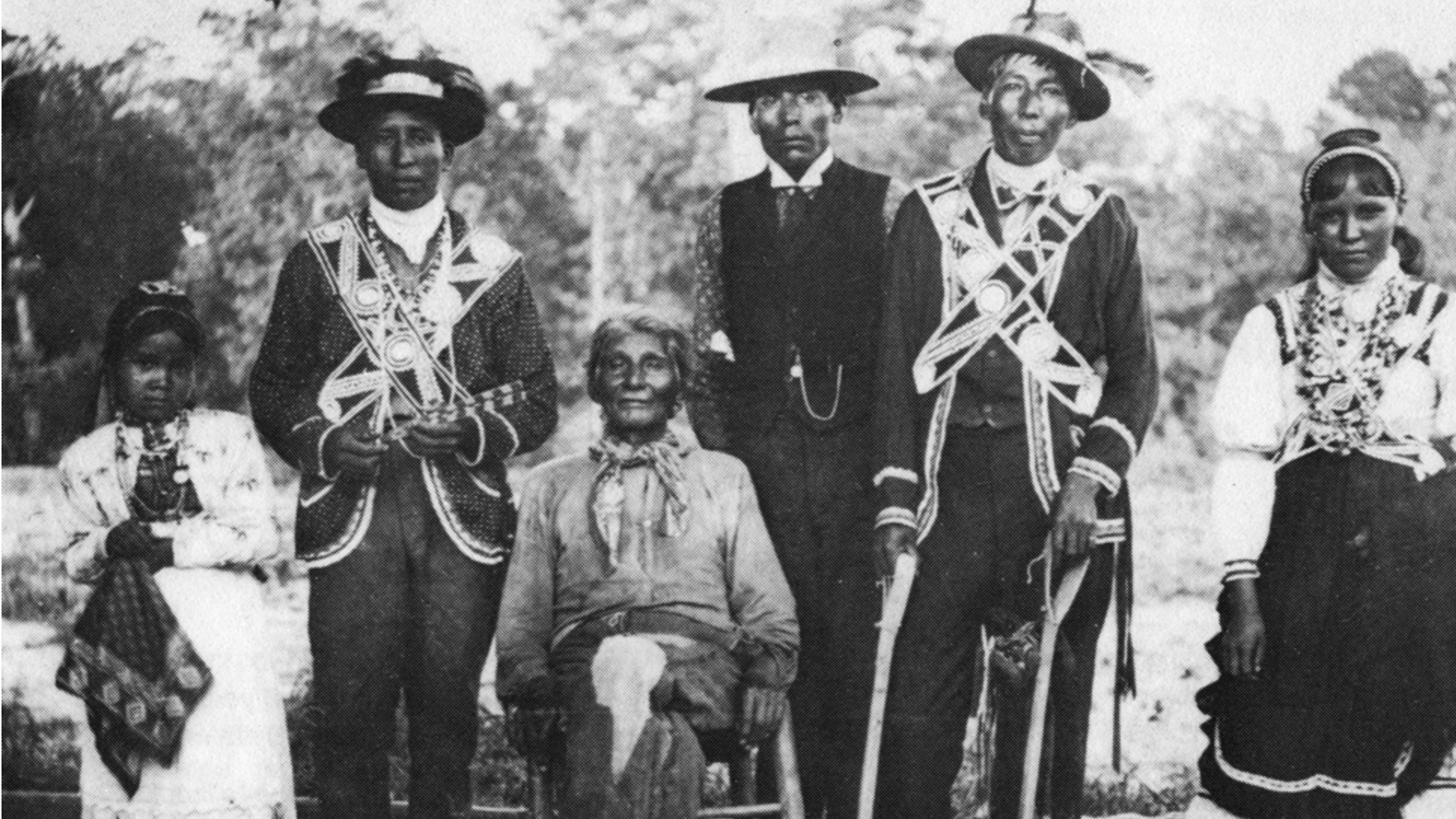
Your journey begins with the very earth of the Jackson Prairie. At Marker #20, you can almost feel the wind across the grasslands where Native Americans lived over 10,000 years ago. This area was a vitalstop for hunters. You can still see the history in ancient tools found in the soil. As you move along, these early paths grow into the Natchez Trace. This 444-mile trail was a busy highway for trade. Marker #2 and Marker #10 show how animal tracks became well-used Indigenous trails. By 1811, the U.S. government turned these paths into a National Post Road. At Marker #8, you stand where the Choctaw Agency once sat. From 1811 to 1823, this was the main meeting place for the U.S. government and the Choctaw people. The trail you are walking was once a vital corridor for diplomacy.
The Yellowley Era and the Civil War: Markers 9, 13, and 17
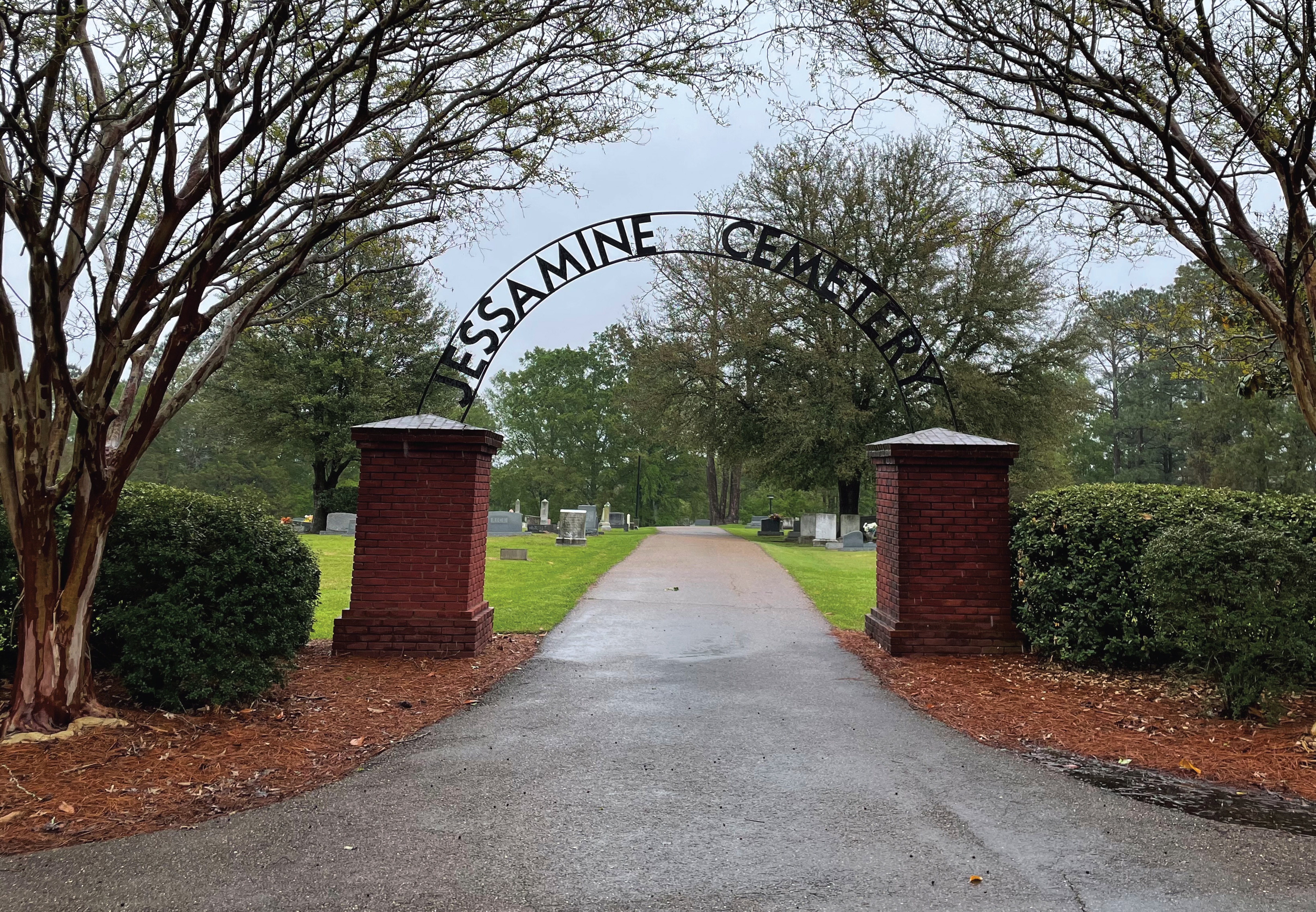
By the mid-1800s, the wilderness began to turn into farmland. In 1853, James B. Yellowley founded a community called Yellowley’s Crossing. You can visit Marker #13 at Jessamine Cemetery to see a moving piece of this past. The graves of the Yellowley and Perkins families face west toward their original home site. It is a quiet place that connects you to the personal lives that built this community. The trail also leads you through the days of the Civil War. While the city was founded after the war, the land saw plenty of action. Marker #17 explains that a local building known as the King’s Inn served as a headquarters for General Stephen Lee. After the war, Union veterans from the North moved here. They
brought a new mix of ideas to this corner of Mississippi.
The Chicago Vision: Markers 3 and 4
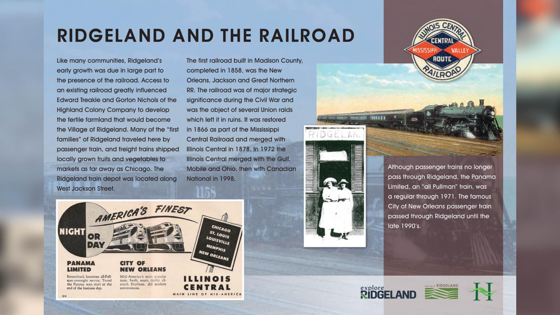
The most significant change for Ridgeland happened in 1896 because of a bold plan from the Midwest. At Marker #3, you stand at the site of the original office for Chicago real estate developers Edward M. Treakle and Gorton W. Nichols. They bought land from Yellowley and started a massive campaign to bring settlers from the North. They promised fertile soil and a fresh start in the Highland Colony. This growth was fueled by the arrival of the railroad. Marker #4 shows how the Illinois Central Railroad shaped the town. The village grew up right around the tracks on Jackson Street. Imagine the sound of the steam engine at the train depot as it welcomed the first families. They arrived by train to start new lives in a place that felt both ancient and brand new.
Commerce, Agriculture, and the Official Tree: Markers 5, 18, and 22
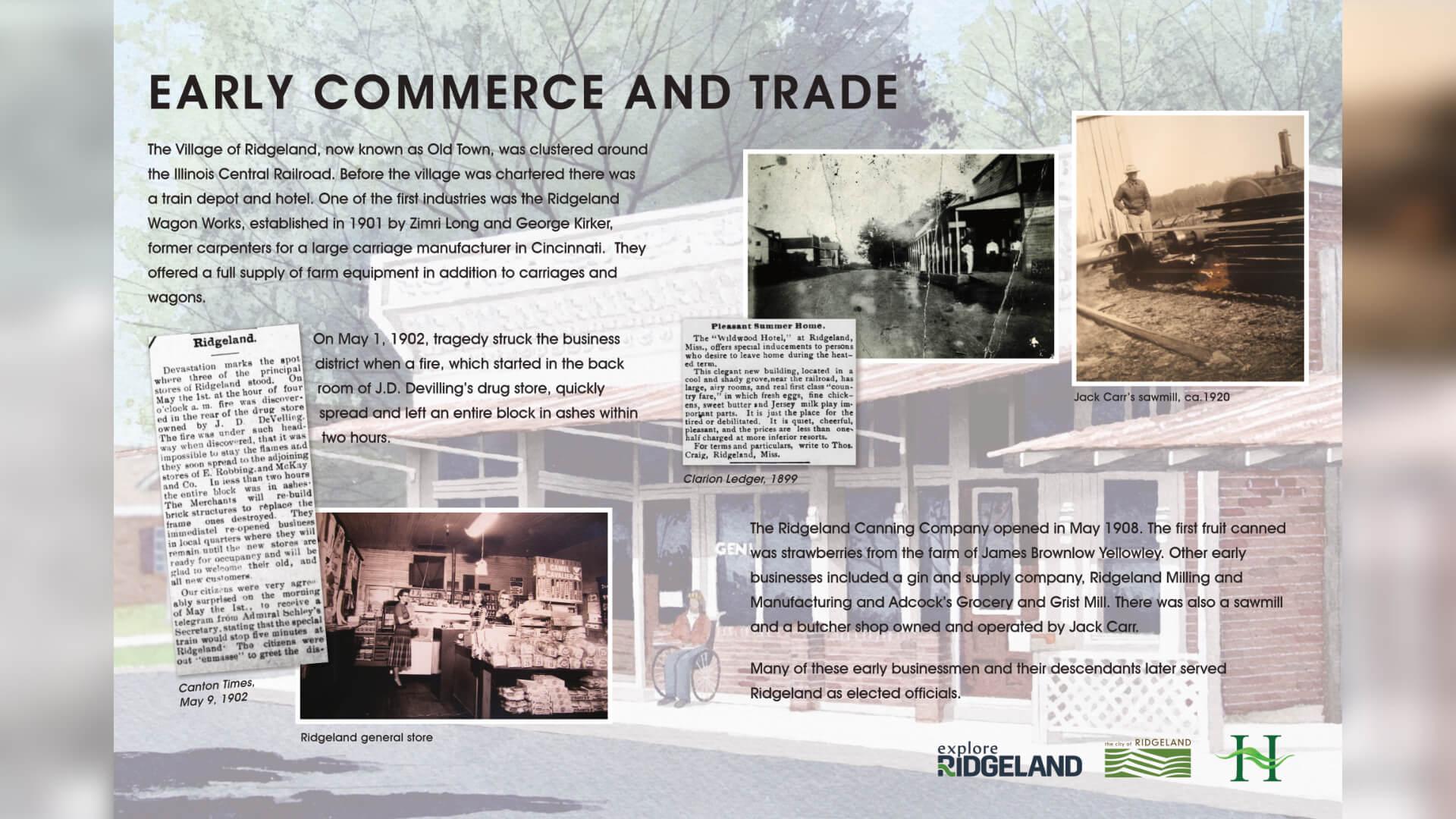
In the early 1900s, Ridgeland became a successful farming hub. At Marker #18, you can learn about an economy built on the sweet harvest of strawberries, peaches, pears, and pecans. This farming life needed tools. Marker #5 shows where the Ridgeland Wagon Works once made carriages and farm equipment. The best symbol of this time is the pecan tree. Marker #22 explains that the big trees you see throughout the city today grew from groves planted around 1896. To celebrate the 125th anniversary of the city in 2024, the pecan tree was named the official city tree. These trees are living links to the first settlers.
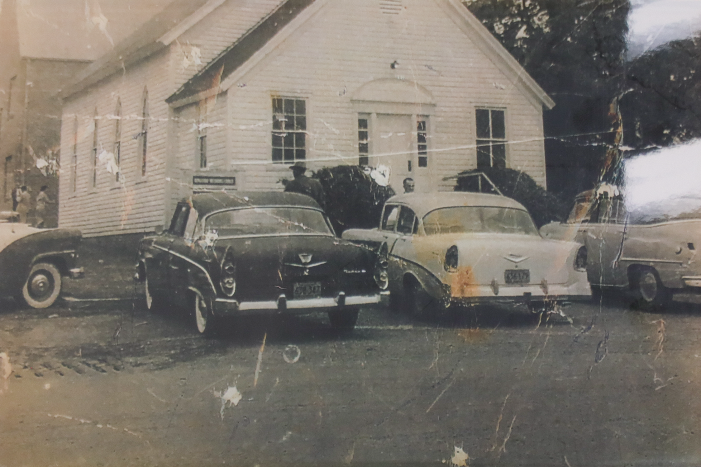
Spiritual and Educational Foundations: Markers 6, 7, and 12
As you explore, you will see the buildings that held the community together. Marker #6 and Marker #7 document the local churches. Wesley Chapel was the first Methodist church in the area and moved to the downtown spot in 1901. Marker #12 tells you about early school days. Since there was no school house, children learned their lessons inside the town hall.
The Modern Transformation: Markers 14, 19, and 21
The mid-1900s brought a massive change to the local landscape. In 1962, the construction of the Ross Barnett Reservoir created a huge 33,000-acre lake for fun and water. Marker #14 tells a surprising story from that time. While digging the dam, workers found the skeleton of a Basilosaurus. This was a 40-million-year-old ancient whale.
The town also shifted from rails to roads. Marker #21 highlights the importance of U.S. Highway 51 and Interstate 55. These roads moved the center of the city toward suburban growth. This led to the building of Northpark Mall at Marker #19 in 1984. What was once 100 acres of farmland became a major retail center.
The Craft of History: Marker 15
Finally, the trail celebrates the local culture. Marker #15 is the Mississippi Craft Center. Here you can see the work of over 400 artisans. You will find traditional skills like quilting, basket weaving, and woodcarving. It is a living link to the many stories of Mississippi.

Conclusion: Walking Through Time
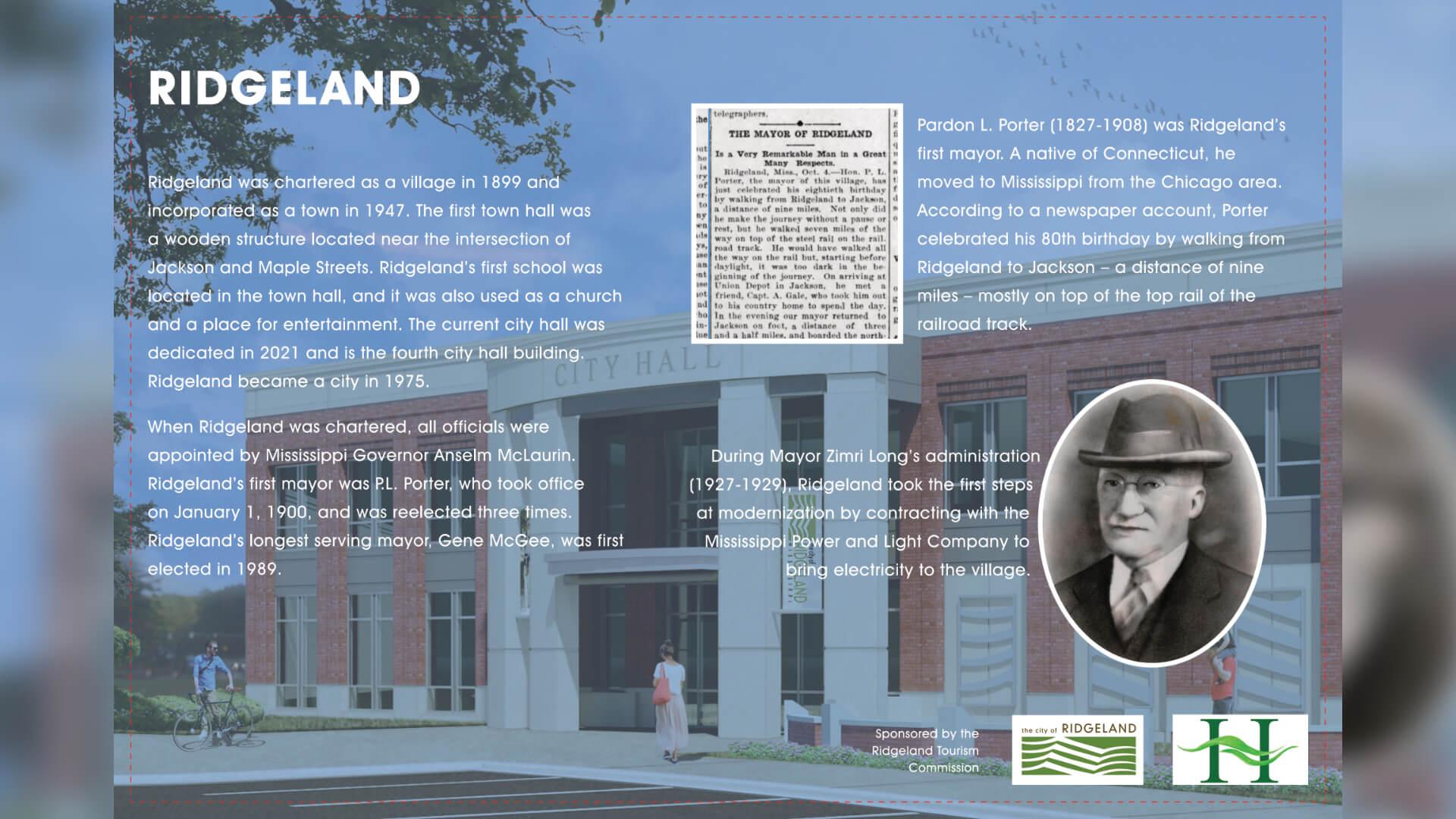
To start your journey, go to Marker #1 at Ridgeland City Hall. You can visit the History Room for a full look at the trail. The path is perfect for exploring by foot or by bike.
Every sign is a story of a choice. You see the choice of a Choctaw agent to stay, a Chicago developer to plant a grove, and a city to save a fossil. Together, these markers tell the story of a city where paths cross and history is written into the soil.
Planning Your Trip
1. Start at City Hall (Marker #1): Grab a map and look around the History Room.
2. Find Hidden Gems: Some markers are tucked away off the main path. Look for them to uncover the full story.
3. See the Change: Compare the old wagon shops at Marker #5 with the modern stores at
Northpark to see how much has changed.
4. Feel the Past: Visit Old Agency Road at Marker #10. You can walk on a piece of the original Natchez Trace and stand where the earliest travelers once stood.